
Back in 2019, my colleague Rob wrote a blog post looking at areas of high poverty in Columbus. This blog post still resonates with a lot of people who understand the history and context of Columbus, and can see how the current concentration of poverty reflects the history of the city.

Since I grew up and now currently live in Saint Paul, Minnesota, I wanted to do this exercise with my own city. I plotted each census tract in Ramsey and Hennepin counties (the home of the cities of Saint Paul and Minneapolis, respectively), highlighting the tracts with a poverty rate of at least 20%. You can see the whole map here.
I-94
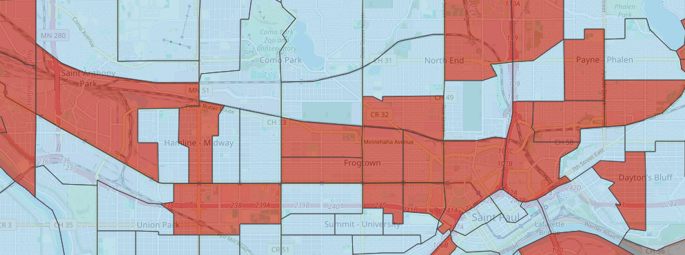
Anyone who knows the history of Saint Paul knows that the construction of I-94 in the late 50s completely changed the fabric of the city. The most famous example of this disruption is the demolition of the Rondo neighborhood, one of the few predominantly Black communities in the city. Today, much of the poverty in Saint Paul follows the I-94 corridor, largely on the North side. The Saint Anthony Park, Midway, Frogtown, and Payne-Phalen neighborhoods all have multiple census tracts with over 20% poverty rates.

In Minneapolis, the I-94 corridor was built through the heart of the Black community in the North neighborhood. Both North Minneapolis and the Rondo neighborhoods were historically redlined parts of the Twin Cities. Like the old Rondo neighborhood in Saint Paul, the disruption caused to North Minneapolis by the creation of I-94 is still felt to this day. That legacy of disruption has resulted in areas of high poverty for many people.
West Side
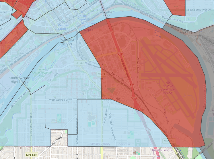
Confusingly, directly South of downtown Saint Paul lies the West Side neighborhood (named because it is on the West bank of the river). This neighborhood currently is home to one of the city's largest Mexican populations, and is one of the few neighborhoods of concentrated poverty that is not along the I-94 corridor.
Seward to Uptown

South of downtown Minneapolis, there is a band of high poverty neighborhoods that stretch from the Seward neighborhood near the river, through the Ceder-Riverside neighborhood, and almost to Uptown and Lake of the Isles. There is a sharp cutoff at Lyndale Avenue, where people living in the Whittier neighborhood to the East experience much higher rates of poverty than their Uptown neighbors to the West. There is an especially sharp disparity when we look at the people who live immediately around Lake of the Isles, one of the wealthiest neighborhoods in Minneapolis.
University of Minnesota

The part of Minneapolis that is on the East bank of the Mississippi river is largely divided into two chunks separated by I-35W. There is Northeast Minneapolis and its many neighborhoods in the North, and the neighborhoods surrounding the University of Minnesota in the South.
Of these two sections, there is much more concentrated poverty surrounding the University campus to the south. These neighborhoods also fall along the I-94 corridor, creating a continuous network of high poverty areas that stretches from downtown Saint Paul all the way to North Minneapolis.
Suburbs

The majority of the suburbs surrounding the Twin Cities have very low poverty rates. Still, there are a few census tracts that have poverty rates over 20%. There are neighborhoods in Bloomington, Eden Prairie, Saint Louis Park, and Brooklyn Park that all have very concentrated poverty rates.